What is an excavation entity and why should you care? If you’re an ITIC user, creating the excavation entity that identifies your work area is one of the single most important things you do when submitting a ticket. Let’s find out why.
An excavation entity is the parcel, circle, route, feature, shapefile, or free-hand/GPS-generated polygon used to identify your area of excavation when you submit an ITIC ticket. The entity that you choose when outlining your work area has a big impact on the results you get from locators marking your work area. Wondering which Gopher State One Call (GSOC) mapping tool is best to outline your proposed excavation area? Keep reading to find out!
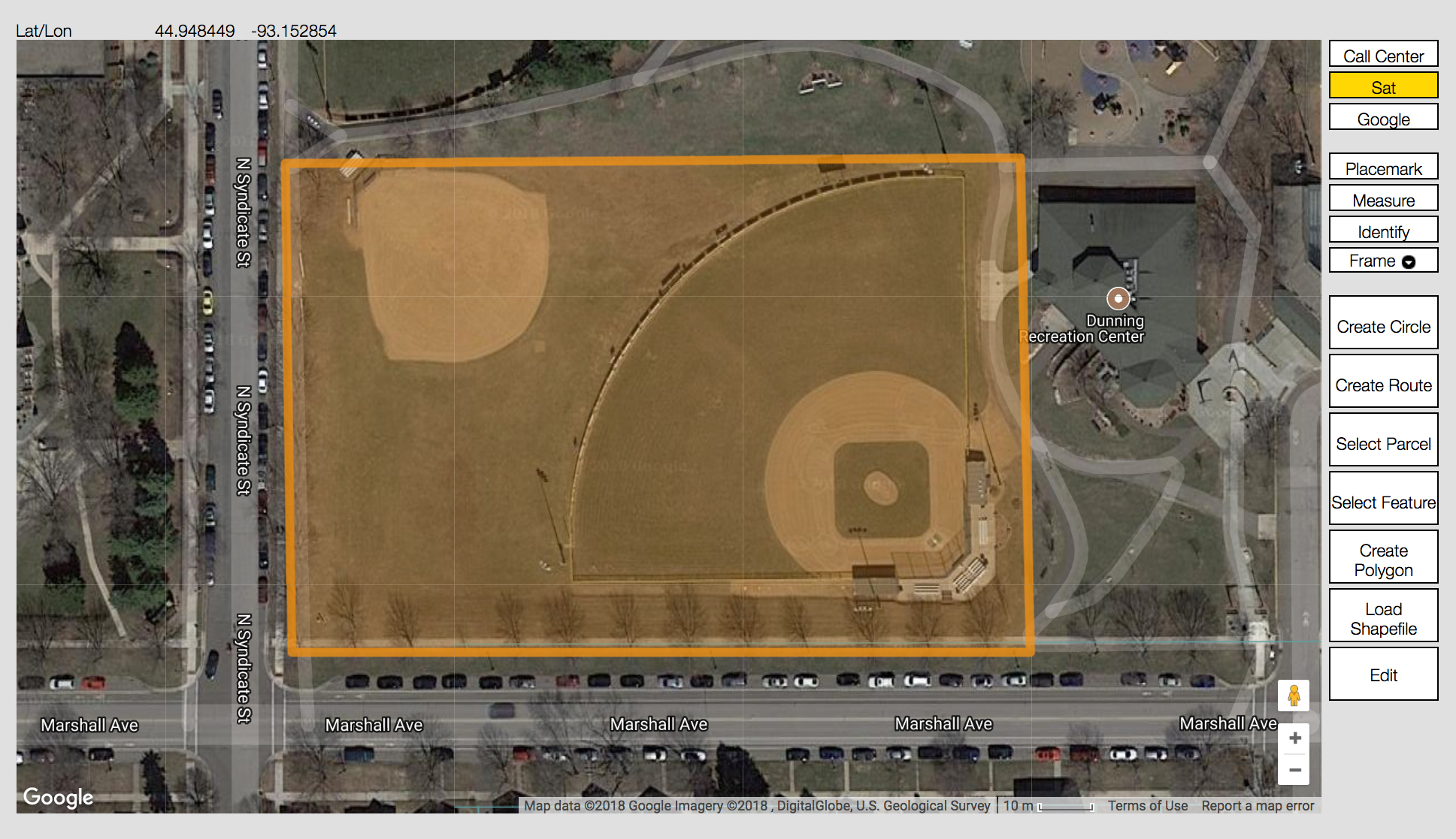
Tools for Creating Excavation Entities
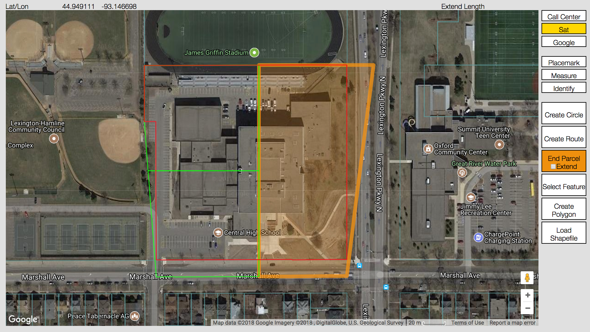
Select Parcel- Create an entity that encompasses all or part of a single parcel with the Select Parcel tool. Parcel size is associated with a single address and does not automatically include the road right of way. You can use the Extend Parcel tool to enlarge the entity to cover adjacent roadway or sidewalk areas. Choose the Select Parcel tool when your excavation will extend throughout the selected area, like when landscaping, gardening, installing a deck, or digging a foundation for an addition.
IMPORTANT NOTE: For best results, use Create Circle instead of Select Parcel for all single point excavations, like installing a “For Sale” sign, setting a mail box, or planting trees.
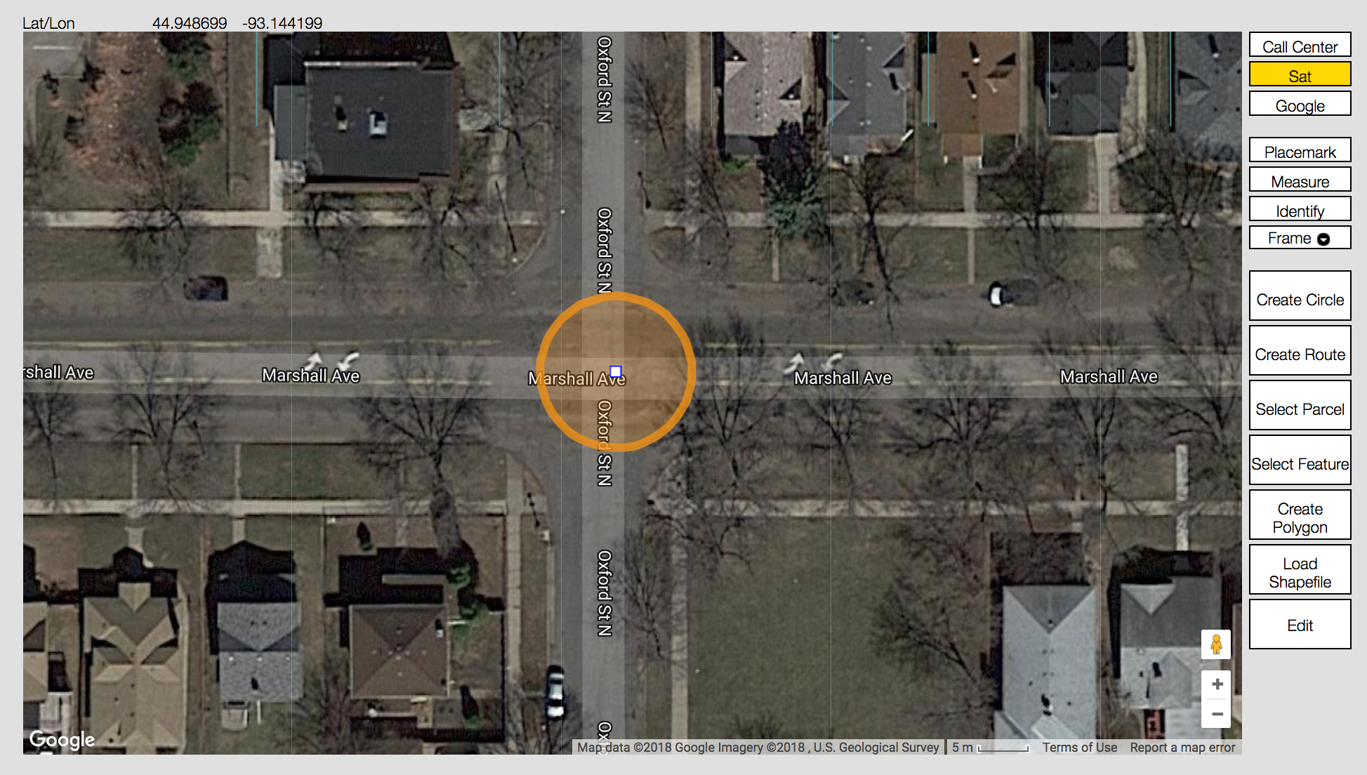
Create Circle- Create a circle by first selecting a point on the map. ITIC will ask you to specify a radius, which it uses to create a circle. Create Circle is the best choice for “single point” excavations like pole installation, tree planting, sign installation, or any other type of work where digging will take place at a single point.
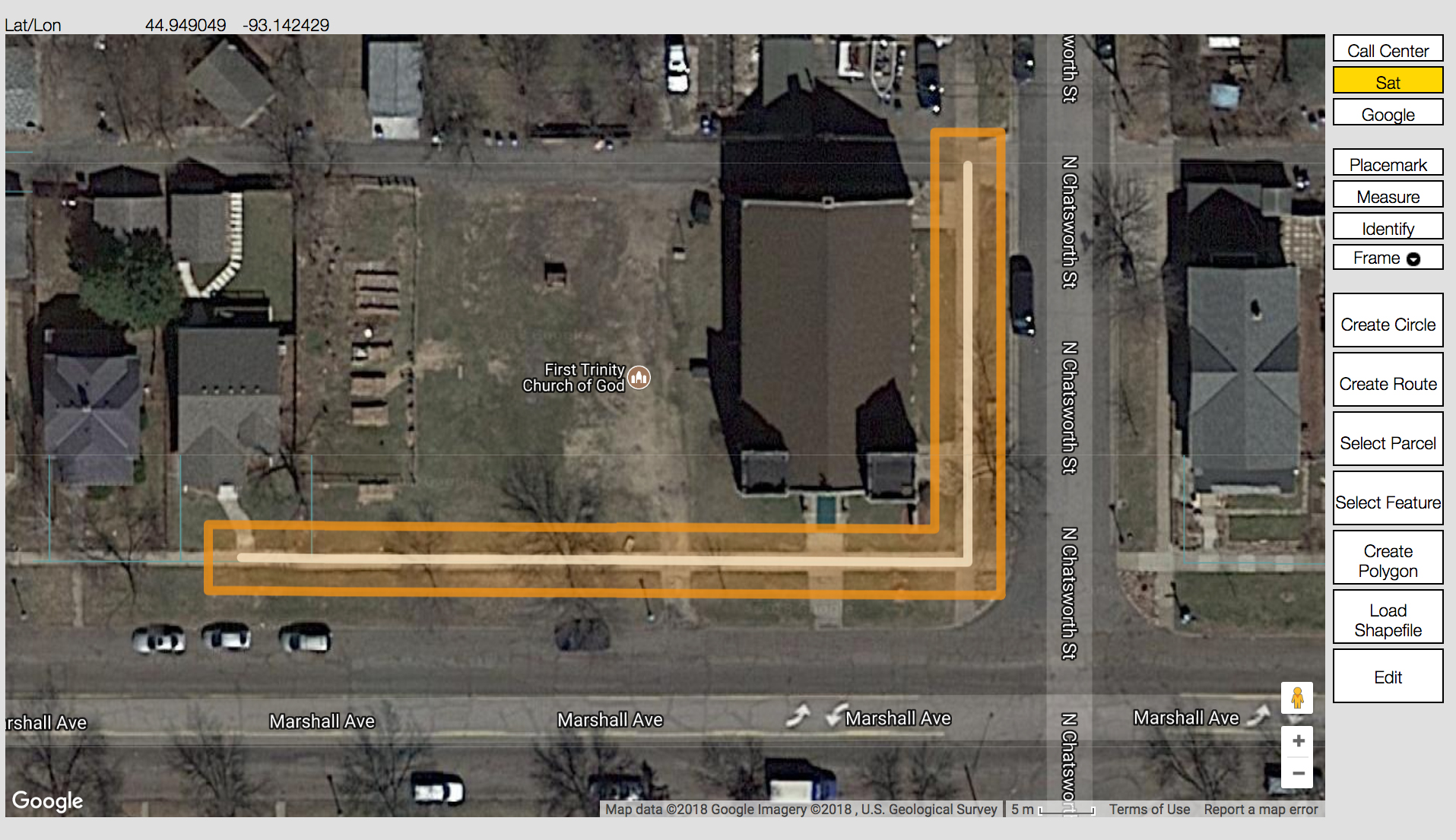
Create Route- Choose the Create Route tool to click your mouse button and establish a series of points on the map that form a continuous line representing your path of excavation. ITIC “connects the dots” and forms a line, which it then converts into an excavation entity based on the “width” you specify. The Create Route tool is the best choice when trenching, performing road repair/replacement, or conducting any other type of work involving a long, narrow excavation area.
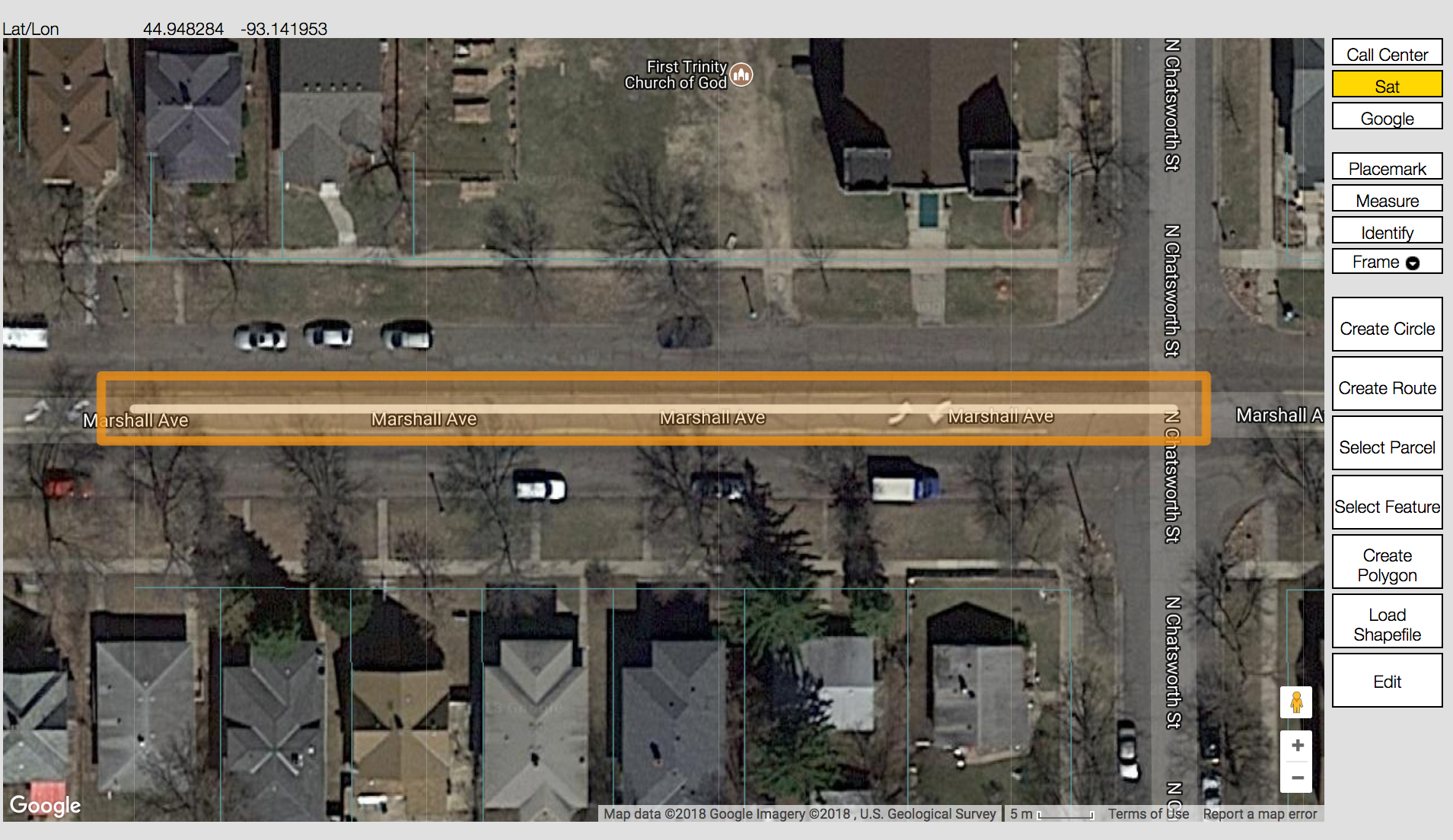
Select Feature- Choose the Select Feature tool to create excavation entities based on available map features, such as roads and highways. It creates excavation entities that look similar to those created by the Create Route tool. Select Feature is a good choice to quickly and easily identify excavation areas along existing roadways.
Create Polygon- Use the Create Polygon tool only when no other mapping options will adequately define the excavation area. Create Polygon is a powerful tool that should be used only when a “free-hand” drawn polygon will cover the excavation area. “Right size” the excavation polygon by keeping it as small as possible, while adequately covering the entire planned excavation area.
IMPORTANT NOTE: Use Create Polygon only when your excavating activity extends throughout the entire area encompassed by your hand-drawn polygon. Use Select Parcel when your work area is contained within a single address (and the adjacent roadway). Use Create Circle for all single point excavation, like installing a “For Sale” sign, setting a mail box, or planting trees.
Shapefiles- Choose this tool if you have shape (.shp/.shx) files that define points, lines, or polygons covering your dig site. ITIC will prompt you to upload the shape file and then convert it to an excavation entity (or entities, if necessary).
GPS- Delineates an excavation entity using a device’s GPS capability while in the field. When physically located at your work site, walk to a corner of your excavation area and click the “Create GPS” button. Walk to each corner of the excavation area and press the “Add to GPS” button at each point. When you’ve encompassed your entire excavation area, click “End GPS” to close out the excavation entity.
IMPORTANT NOTE: Use this tool only when inputting tickets directly from the jobsite.
Selecting the proper mapping tool helps locators and facility operators respond efficiently, in a timely manner, and with the necessary locates, maps, or other required information. Remember, always contact GSOC 48 hours in advance, excluding weekends and holidays, before you begin any type of excavation. Save time by filing an online ticket with ITIC here!